
Your walk at a glance
- Walking distance
- 1.5 km
- Walking time, estimated
- 25 min
- Allow with stops
- 55–80 min
- Ascent / descent, estimated
- ↑ 80 / ↓ 0 m
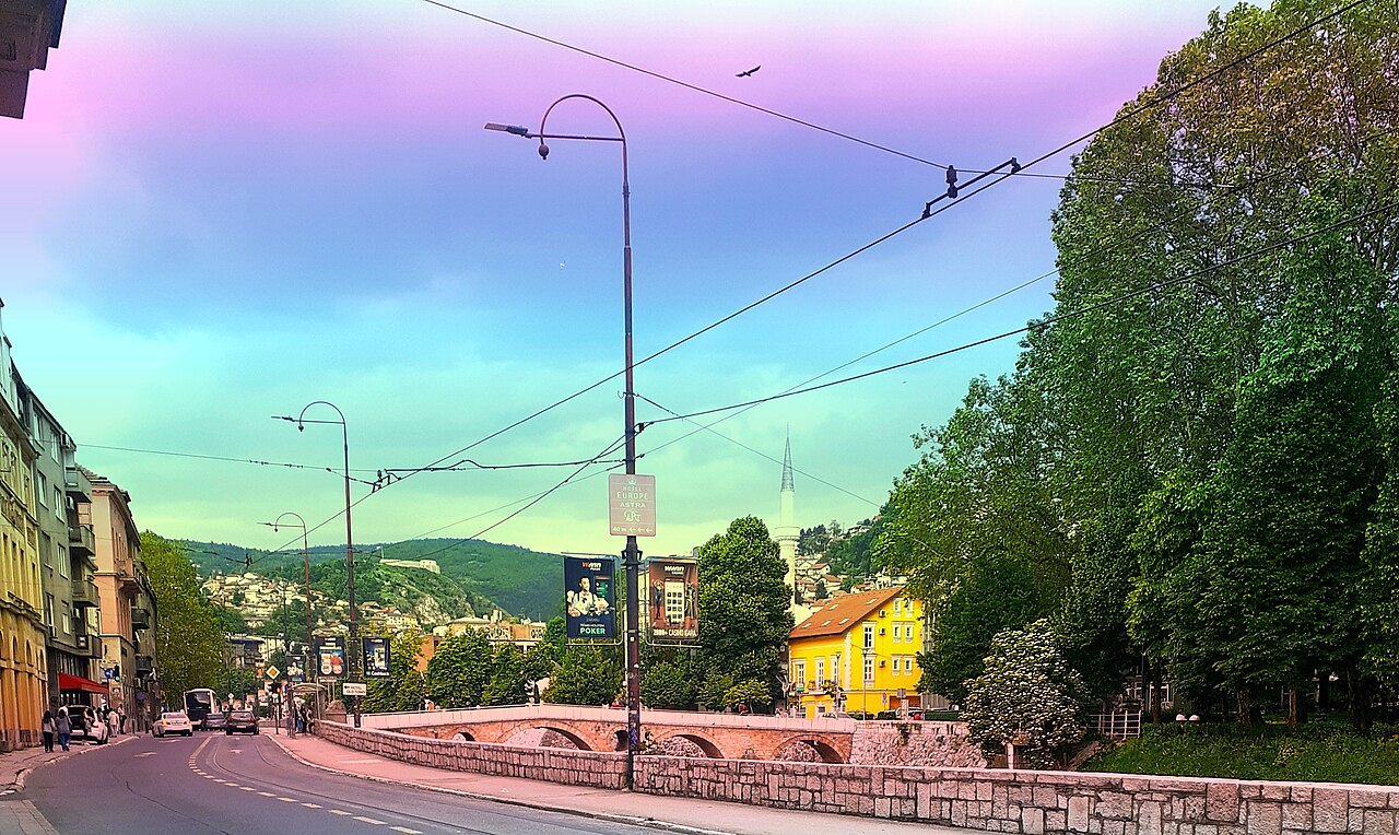
Start: Latin Bridge
Finish: Yellow Bastion
River embankments, road crossings and a substantial climb to the bastion.
Open this walking route ↗Remember the city from below first
At Latin Bridge, notice how the crossing connects with the streets beside it. Continue comparing bridges and façades while using the Miljacka to keep your bearings. This gives the walk a clear sequence. Watch road crossings along the river and pick a photographic position before stopping on a narrow stretch of pavement.
At City Hall, step back to see the building as a whole, then look towards the river again. Remember its outline for later: finding a familiar landmark makes a panorama more meaningful. Passing Sebilj returns you to the scale of the old town before streets lead uphill away from the bazaar.
Treat the climb as its own decision
At Sebilj, assess your energy and the weather before the final section. Finishing below is reasonable if you are tired, although it becomes a shortened walk without the viewpoint. If continuing, use a steady pace and allow pauses. Apparent closeness on the map does not remove the slope or verify an accessible approach.
From Yellow Bastion, look for landmarks you encountered beside the river and observe how the city sits between surrounding slopes. Stay on permitted paths and viewing areas. Published improvements do not guarantee today’s access, and this route has not been checked on foot. For an evening visit, plan the descent before spending your remaining daylight waiting for photographs.
The map and your stops
The outline follows the saved pedestrian track. External navigation may choose another path. The stop marker does not guarantee an open entrance.
Latin Bridge
This historic stone bridge crosses the Miljacka at the southern edge of the old centre.
View the arches from the embankment, then cross using the pedestrian area.
Approach or exterior view; admission to the interior is not confirmed.
Show on the city map ↗Emperor’s Mosque
This domed mosque with a courtyard stands on the southern bank of the Miljacka opposite the old centre.
Start with the exterior and account for prayers when planning entry.
Approach or exterior view; admission to the interior is not confirmed.
Show on the city map ↗Sarajevo City Hall
The restored City Hall with its distinctive façade stands at the eastern edge of the old town.
View the façades from the river side; interior exhibitions can be added to the walk.
Approach or exterior view; admission to the interior is not confirmed.
Show on the city map ↗Sebilj Fountain
This wooden fountain pavilion is a familiar landmark on Baščaršija Square.
Step to the edge of the square to see the pavilion and surrounding shops.
Approach or exterior view; admission to the interior is not confirmed.
Show on the city map ↗Yellow Bastion
This hilltop fortification offers a panorama of old Sarajevo and the Miljacka valley.
Expect a noticeable climb; leave daylight for the return and keep away from unprotected edges.
Approach or exterior view; admission to the interior is not confirmed.
Show on the city map ↗
Before you go
- Carry water before climbing and take your main rest while you are still near the bazaar.
- Keep the Yellow Bastion name handy so you do not confuse it with another Sarajevo fortification.
- Calculate the return separately: this route finishes above the city rather than back at the starting bridge.
Terrain and access
River embankments, road crossings and a substantial climb to the bastion.
- Calculated using the OpenStreetMap pedestrian network; not verified by an on-site walk. Closures and barriers may change the path.
- Visit time is an editorial estimate. Check museum and religious-site admission, tickets and access separately.
Times are estimates, not opening hours. Ticketed visits and queues can extend the walk. Accessibility has not been surveyed on site.
Questions before the walk
Do I need to visit at sunset?
No. Daylight works well for reading the city panorama and makes the descent easier to plan. An evening view is a preference dependent on weather and your schedule.
Is this an easy riverside stroll?
Only the first section matches that description. The full route includes a substantial uphill finish, so choose it by the effort involved rather than distance alone.
Sources and verification
Written by walkymap from remotely checked sources. No on-site walk is claimed.
City of Sarajevo — Sarajevski mostovi simboli vremena ·
© OpenStreetMap contributors · ODbL. Track geometry and distance are from the route dataset.
Elevation estimate: Mapterhorn. Terrain model; stairs and small changes in level may be missed.