
Your walk at a glance
- Walking distance
- 3.3 km
- Walking time, estimated
- 60 min
- Allow with stops
- 105–180 min
- Ascent / descent, estimated
- ↑ 120 / ↓ 0 m
Start: Cascade Complex
Finish: Mother Armenia
Hills and steps; Victory Park is approached by streets.
Open this walking route ↗Use the Cascade as an outdoor gallery
At the lower Cascade, compare the sculptures’ shapes with the geometry of pale stone. Climbing every staircase is unnecessary for understanding the space. Choose a few works, view them from different sides and keep the passages between visitors clear.
This route does not use the unfinished upper Cascade as a through-passage. A convincing view of stairs from below does not establish an exit into the upper neighbourhoods. Continue along the indicated streets; individual terraces and indoor escalators need separate access checks.
Choose between manuscripts and more height
The Matenadaran combines a museum, manuscript repository and research institute. Outside, notice the weight of its stone volume and the figures by the façade. Following the open Cascade setting, it offers a different architectural language even without an indoor visit.
If manuscripts are your main interest, give the museum its own time allowance and reconsider the remaining walk afterwards. A gallery visit is not merely a brief waypoint. Finishing in the lower streets may be more satisfying than rushing uphill to complete a checklist.
Climb with a return plan
The continuation includes urban streets, slopes and steps. Bring water, retain enough daylight and pause before fatigue builds. If climbing is difficult, limit the outing beforehand: the full route has not been established as step-free or suitable for every mobility need.
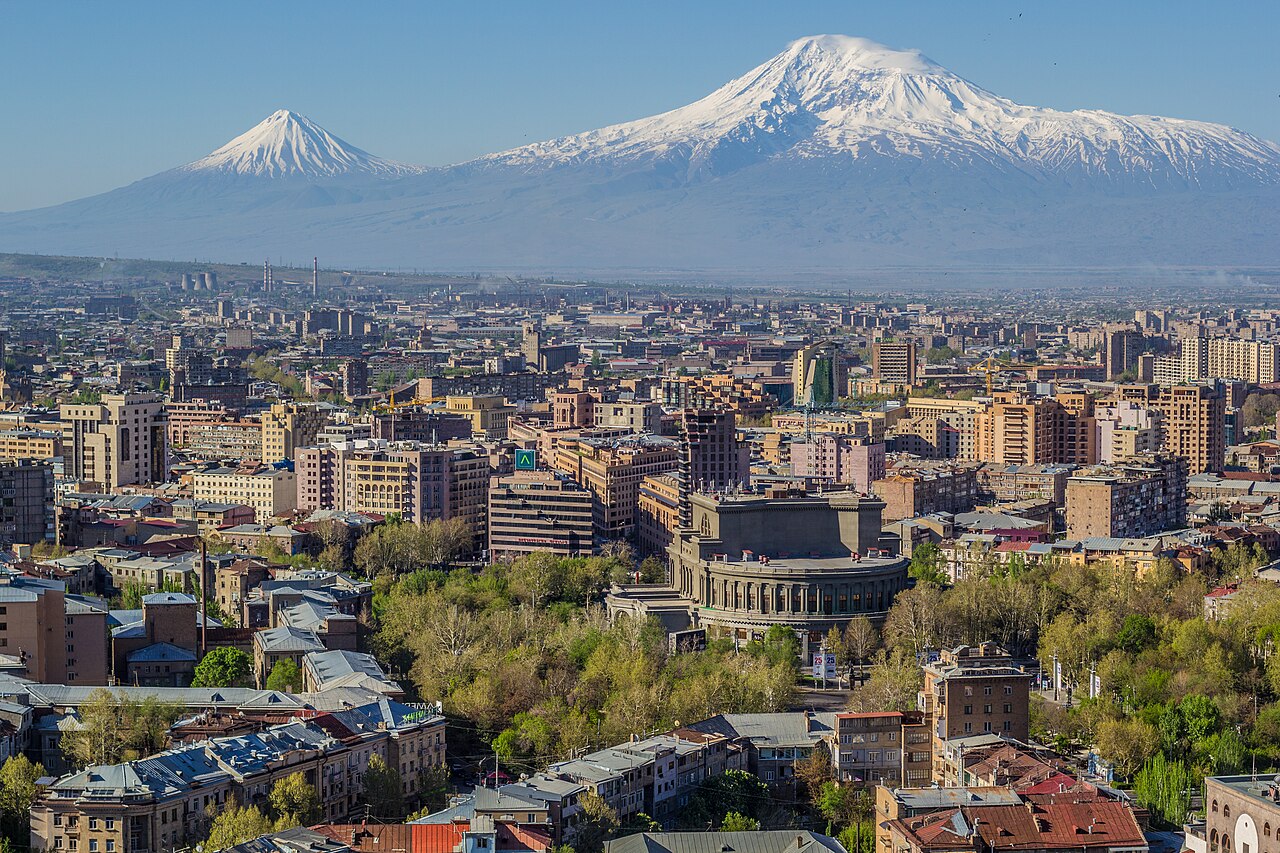
From Victory Park and Mother Armenia, observe how the streets and buildings form a broader city pattern. Distant visibility depends on conditions, so a clear outline of Ararat is not guaranteed. Remember that descending afterwards will also require time and energy.
The map and your stops
The outline follows the saved pedestrian track. External navigation may choose another path. The stop marker does not guarantee an open entrance.
Cascade Complex
Terraces, stairs and contemporary sculptures connect the centre with the upper city.
There are many steps; check terrace and indoor escalator access locally.
Object approach or exterior view; interiors are not part of route geometry.
Show on the city map ↗Matenadaran
A museum and research repository of ancient manuscripts named after Mesrop Mashtots.
The approach is uphill; check museum admission and hours before visiting.
Object approach or exterior view; interiors are not part of route geometry.
Show on the city map ↗Victory Park approach
Intermediate walking approach point.
Show on the city map ↗Victory Park
A hilltop park with walking alleys around the Mother Armenia monument.
Follow open park paths; rides and museum visits are additional to walking time.
Object approach or exterior view; interiors are not part of route geometry.
Show on the city map ↗Mother Armenia
A hilltop monument with a broad panorama over Yerevan.
Views depend on visibility; the museum in the pedestal has separate opening arrangements.
Object approach or exterior view; interiors are not part of route geometry.
Show on the city map ↗
Before you go
- Check the forecast and actual visibility before committing to the upper section.
- Do not shorten the walk through barriers, closed stairs or unfinished areas.
- Make the manuscript collection a separate priority if you want a detailed museum visit.
Terrain and access
Hills and steps; Victory Park is approached by streets.
- The line uses OpenStreetMap; closures, barriers and actual conditions may differ.
- Check tickets, museum entry and prayer access separately.
- The route visits the lower Cascade; the unfinished upper section is not used as a through passage.
Times are estimates, not opening hours. Ticketed visits and queues can extend the walk. Accessibility has not been surveyed on site.
Questions before the walk
Can I walk straight through the whole Cascade?
This itinerary visits the lower Cascade, then uses city streets. It does not assume an uninterrupted passage through the complex.
What if I do not want a hill walk?
Explore the lower Cascade and assess the Matenadaran separately. Choose the central-squares route for gentler gradients.
Sources and verification
Written by walkymap from remotely checked sources. No on-site walk is claimed.
Visit Yerevan, official city tourism website — Cascade Complex ·
Visit Yerevan, official city tourism website — Matenadaran ·
Armenia Travel, national tourism portal — Yerevan ·
© OpenStreetMap contributors · ODbL. Track geometry and distance are from the route dataset.
Elevation estimate: Mapterhorn. Terrain model; stairs and small changes in level may be missed.