
Your walk at a glance
- Walking distance
- 2.1 km
- Walking time, estimated
- 30 min
- Allow with stops
- 55–80 min
- Ascent / descent, estimated
- ↑ 0 / ↓ 0 m
Start: Toktogul Satylganov Philharmonic Hall
Finish: Ala-Too Square
Pavements, park paths and avenue crossings.
Open this walking route ↗Notice how buildings meet the street
At the Philharmonic, look at the approach as well as the façade. Find a position that holds the whole building, then move closer to one detail. Compare the distance you need for an overall view with how you might observe a house on a narrow street. This is a direct way to feel central Bishkek’s scale.
Use Panfilov Park to change pace after the streets. Follow an available path, take a break and locate the direction towards the museum before continuing. There is no need to explore every branching path or depend on an attraction operating. The park provides a pause and a useful comparison with the surrounding public squares.
Separate the museum from the square
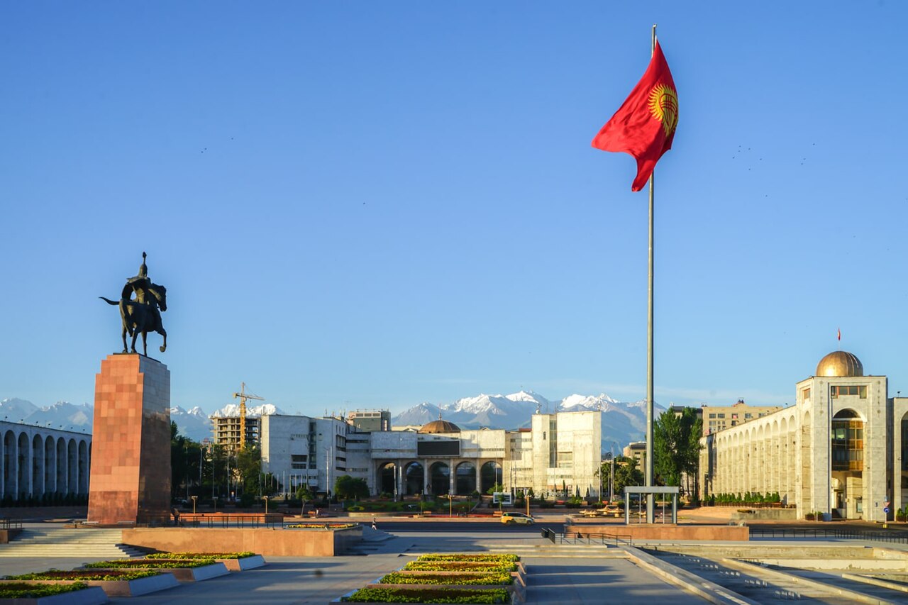
The National Historical Museum can be your main cultural visit if you check its arrangements beforehand. For an exterior walk, notice how the building relates to the Manas monument and Ala-Too. Find a broad view before approaching the monument. This makes the group understandable as an ensemble rather than three unrelated markers on your phone.
On the square, observe the open space and routes towards neighbouring streets. Its appearance changed through reconstruction, so an older photograph should not be used as an exact passage plan. Use designated avenue crossings and allow time to reach them. The walking estimate does not cover museum viewing, breaks or a possible diversion around a barrier.
The map and your stops
The outline follows the saved pedestrian track. External navigation may choose another path. The stop marker does not guarantee an open entrance.
Toktogul Satylganov Philharmonic Hall
A national concert venue on Chuy Avenue.
Explore the facade and forecourt; select concerts from the current programme.
Approach or exterior view; admission to the interior is not confirmed.
Show on the city map ↗Panfilov Park
An urban park with walking paths and amusement rides.
Check ride operations and any restricted areas locally.
Approach or exterior view; admission to the interior is not confirmed.
Show on the city map ↗National Historical Museum
A museum of Kyrgyzstan’s history, ethnography and culture beside Ala-Too.
Plan the galleries as a separate visit and check the schedule.
Approach or exterior view; admission to the interior is not confirmed.
Show on the city map ↗Manas Monument on Ala-Too Square
A monument to the hero of the Kyrgyz epic in front of the history museum.
View it from the square while leaving the paths by the pedestal clear.
Approach or exterior view; admission to the interior is not confirmed.
Show on the city map ↗Ala-Too Square
Bishkek’s central square, with monuments and fountain areas.
Walking access may change during state celebrations.
Approach or exterior view; admission to the interior is not confirmed.
Show on the city map ↗
Before you go
- Choose an interior visit or an architectural pause at the museum.
- Compare a broad square view with a closer view of Manas.
- Locate the permitted crossing before approaching the other side of an avenue.
Terrain and access
Pavements, park paths and avenue crossings.
- Calculated using the OpenStreetMap pedestrian network; not verified by an on-site walk. Closures and barriers may change the path.
- Visit time is an editorial estimate. Check museum and religious-site admission, tickets and access separately.
Times are estimates, not opening hours. Ticketed visits and queues can extend the walk. Accessibility has not been surveyed on site.
Questions before the walk
Do I need a ticket for the whole walk?
There is no combined route ticket. Museum admission and other services are separate; street stops can be viewed from public approaches.
What is a useful follow-up Bishkek walk?
Choose Erkindik towards the station for a calmer urban sequence. The catalogue also has a separate route devoted to art and memorial places.
Sources and verification
Written by walkymap from remotely checked sources. No on-site walk is claimed.
Мэрия Бишкека — Торжественное открытие обновленной площади Ала-Тоо ·
Департамент туризма мэрии Бишкека — Национальный исторический музей ·
© OpenStreetMap contributors · ODbL. Track geometry and distance are from the route dataset.
Elevation estimate: Mapterhorn. Terrain model; stairs and small changes in level may be missed.