.jpg)
Your walk at a glance
- Walking distance
- 1.4 km
- Walking time, estimated
- 25 min
- Allow with stops
- 55–75 min
- Ascent / descent, estimated
- ↑ 50 / ↓ 10 m
Start: Danube Park
Finish: Petrovaradin Fortress
Bridge crossing followed by a climb to the fortress; steps and uneven surfaces may occur.
Open this walking route ↗Connect the panorama with your approach
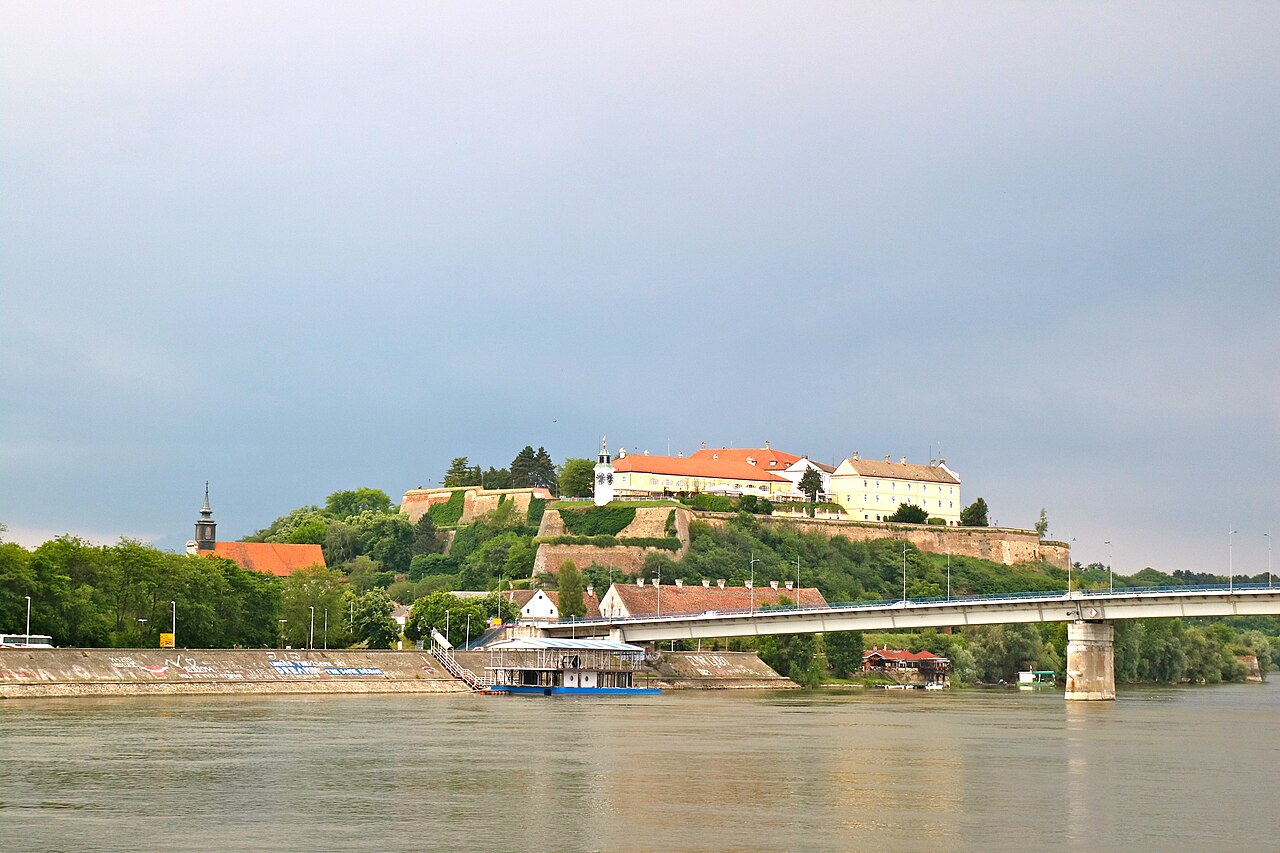
Use Danube Park for a quiet pause before the exposed crossing. On Varadin Bridge, notice how the fortress looks from river level. Stop for photographs only where other pedestrians have room to pass. Avoid turning the crossing itself into a long photo session; the main viewing stops are still ahead beyond the bridge.
At the Clock Tower, examine the dial before turning to the panorama: the large hand indicates hours and the smaller one minutes. Then find the bridge you used. Connecting the view with your own approach makes the landscape easier to read. Within the fortress, focus on changing levels and defensive shapes instead of trying to cover everything.
Leave room for the uphill section
The relatively level city centre does not describe the effort needed at the finish. Beyond the bridge, expect a climb, possible stairs and uneven surfaces. Keep earlier stops shorter if you want more energy for the upper section. A suitable approach for limited mobility would need separate verification; a short distance is not proof of accessibility.
Decide in advance whether you will return on foot and where you need to end up. That return is not automatically included in the displayed distance. Museums, galleries and underground spaces are separate visits. Avoid treating an unknown passage as a shortcut; follow local signs when a section is closed and keep spare time for an alternative.
The map and your stops
The outline follows the saved pedestrian track. External navigation may choose another path. The stop marker does not guarantee an open entrance.
Danube Park
A green park beside the old centre, with a pond, trees and monuments.
Take a break by the pond before continuing to the museum or river.
Approach or exterior view; admission to the interior is not confirmed.
Show on the city map ↗Varadin Bridge
This Danube bridge connects central Novi Sad with Petrovaradin.
Keep to the pedestrian side; the fortress is visible on the approach and from the bridge.
Approach or exterior view; admission to the interior is not confirmed.
Show on the city map ↗Petrovaradin Clock Tower
The clock above the Danube shows hours with the large hand and minutes with the small one.
The climb from the lower town takes effort; pause at the viewpoint.
Approach or exterior view; admission to the interior is not confirmed.
Show on the city map ↗Petrovaradin Fortress
The riverside fortress complex combines fortifications, museum spaces and artists’ studios.
Use marked paths; underground tours need separate planning.
Approach or exterior view; admission to the interior is not confirmed.
Show on the city map ↗
Before you go
- Carry water before reaching the bridge so your plan does not depend on finding a particular vendor.
- Consider wind and rain before the climb, because exposed viewpoints are less appealing in poor weather.
- For an evening view, keep enough daylight in reserve for a comfortable descent and onward journey.
Terrain and access
Bridge crossing followed by a climb to the fortress; steps and uneven surfaces may occur.
- Calculated using the OpenStreetMap pedestrian network; not verified by an on-site walk. Closures and barriers may change the path.
- Visit time is an editorial estimate. Check museum and religious-site admission, tickets and access separately.
Times are estimates, not opening hours. Ticketed visits and queues can extend the walk. Accessibility has not been surveyed on site.
Questions before the walk
Can I experience the fortress without visiting a museum?
Yes. This walk centres on the approach, exterior sightseeing and panorama, without guaranteeing access to every part of the complex.
Is it suitable if I avoid stairs?
That cannot be confirmed without checking alternatives. The catalogue explicitly notes possible stairs and a climb; the old centre offers a more level walking option.
Sources and verification
Written by walkymap from remotely checked sources. No on-site walk is claimed.
Tourism Organisation of Novi Sad — Petrovaradin fortress ·
Tourism Organisation of Novi Sad — Clock Tower ·
© OpenStreetMap contributors · ODbL. Track geometry and distance are from the route dataset.
Elevation estimate: Mapterhorn. Terrain model; stairs and small changes in level may be missed.