Why the map line bends
Park paths do not follow Manhattan’s rectangular grid. The lake and rocky ground require detours, and a bridge visible from the shore is not necessarily on the shortest path. Follow the paths rather than drawing straight lines across lawns, water or barriers
Four unhurried stops
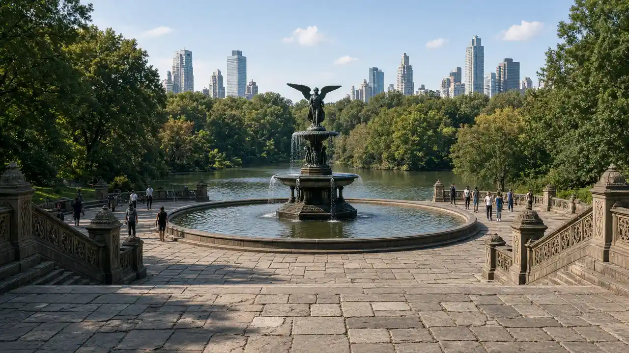
Leave room around the mosaic at Strawberry Fields. On Bow Bridge, notice both the curved railings and reflections along the opposite shore. Belvedere adds a climb and stone architecture; Bethesda adds stairs, an arcade and an open view towards the water. Pauses are more rewarding here than collecting stops quickly
Stops in route order
Strawberry Fields — Memorial landscape with the Imagine mosaic by the park's western edge. Keep the mosaic accessible when others are waiting
Bow Bridge — Low cast-iron bridge over the lake amid trees and city skylines. Leave space for people crossing the narrow bridge
Belvedere Castle — Stone park pavilion on a rock above Turtle Pond. Allow for the climb to the terraces beyond the flatter paths
Bethesda Terrace and Fountain — Two-level terrace, arcade and fountain in Central Park. Allow for stairs and keep the arcade passage clear
Access and planning
The route includes changes in level and is not verified as step-free. Allow for wet steps after rain. Museums at the park edges, boat hire and the far northern section are separate plans, not hidden parts of this walk
For a city continuation, reverse the Rockefeller Center to Bethesda route
Map and stops
The numbered markers match the stops below. A marker does not guarantee an open entrance
Access: Approach or exterior view; admission to the interior is not confirmed
Strawberry Fields
Memorial landscape with the Imagine mosaic by the park's western edge
Keep the mosaic accessible when others are waiting
Show on the city map ↗Bow Bridge
Low cast-iron bridge over the lake amid trees and city skylines
Leave space for people crossing the narrow bridge
Show on the city map ↗Belvedere Castle
Stone park pavilion on a rock above Turtle Pond
Allow for the climb to the terraces beyond the flatter paths
Show on the city map ↗Bethesda Terrace and Fountain
Two-level terrace, arcade and fountain in Central Park
Allow for stairs and keep the arcade passage clear
Show on the city map ↗
Before the walk
- Winding paths, stairs and small hills
- Walking time excludes exhibitions, queues and long breaks
- Calculated using the OSM pedestrian network; not verified by an on-site walk
- View buildings from outside; closed courtyards and interior passages are not essential parts of the walk
Check hours, tickets and access with each venue. Barriers may change the track and queues may add time. Accessibility has not been surveyed on site
Questions before the walk
How long is this walk?
The mapped route is 1.9 km, with about 30 minutes of walking at an assumed 4.2 km/h. Breaks, visits and terrain can increase the total time
What should be checked before setting out?
The route includes changes in level and is not verified as step-free. Allow for wet steps after rain. Museums at the park edges, boat hire and the far northern section are separate plans, not hidden parts of this walk
How can the walk be shortened or continued?
For a city continuation, reverse the Rockefeller Center to Bethesda route
Sources and verification
Written by walkymap from remotely checked sources. No on-site walk is claimed
assets.centralparknyc.org — assets.centralparknyc.org ·
en.wikipedia.org — Strawberry Fields (memorial) ·
en.wikipedia.org — Bow Bridge (Central Park) ·
en.wikipedia.org — Belvedere Castle ·
en.wikipedia.org — Bethesda Terrace and Fountain ·
© OpenStreetMap contributors · ODbL. Track geometry and distance are from the route dataset
Elevation estimate: Mapterhorn. Terrain model; stairs and small changes in level may be missed