From the fort to the financial blocks
After the open waterfront, the route enters the narrower streets around Broad Street. View the Exchange and Federal Hall as a pair: their classical façades stand beside vertical office walls. Trinity provides a different landmark, with its spire and small historic grounds among the towers
Memorial and new architecture
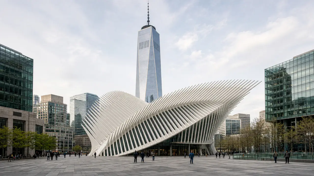
At the memorial pools, an unhurried pause matters more than a quick sequence of photographs. Afterwards, compare One World Trade Center’s vertical mass with the open white Oculus shell. The transport hub remains a working space, so entrance stops should not obstruct passengers
Stops in route order
Castle Clinton — Circular fort at Manhattan's southern tip. Plan any Statue of Liberty ferry trip separately from this walk
Charging Bull — Bronze bull at the Broadway junction beside Bowling Green. Stay off the roadway when taking photographs
New York Stock Exchange Building — Classical stock-exchange façade with columns on Broad Street. View it from the street; the trading floor is not part of the walk
Federal Hall — Columned memorial at the site of Washington's first inauguration. Check exhibition access separately
Trinity Church — Gothic Revival church and historic churchyard among skyscrapers. Compare the spire with the surrounding towers
National September 11 Memorial & Museum — Two memorial pools in the footprints of the former towers. Keep a quiet pace and give visitors space beside the names
World Trade Center station — Transport hub beneath a white ribbed above-ground pavilion. View the wings from the plaza without blocking passenger flows
One World Trade Center — Glass tower with chamfered sides and a tall spire. Book the observatory separately; the walk stays at ground level
Access and planning
The Statue of Liberty ferry, 9/11 Museum and observation decks are not included in the street walk. Allow a separate time block for any of them. Barriers around secured sites may change the precise approach
Choose Wall Street for a shorter version, or continue via the memorial, Woolworth and City Hall
Map and stops
The numbered markers match the stops below. A marker does not guarantee an open entrance
Access: Approach or exterior view; admission to the interior is not confirmed
Castle Clinton
Circular fort at Manhattan's southern tip
Plan any Statue of Liberty ferry trip separately from this walk
Show on the city map ↗Charging Bull
Bronze bull at the Broadway junction beside Bowling Green
Stay off the roadway when taking photographs
Show on the city map ↗New York Stock Exchange Building
Classical stock-exchange façade with columns on Broad Street
View it from the street; the trading floor is not part of the walk
Show on the city map ↗Federal Hall
Columned memorial at the site of Washington's first inauguration
Check exhibition access separately
Show on the city map ↗Trinity Church
Gothic Revival church and historic churchyard among skyscrapers
Compare the spire with the surrounding towers
Show on the city map ↗National September 11 Memorial & Museum
Two memorial pools in the footprints of the former towers
Keep a quiet pace and give visitors space beside the names
Show on the city map ↗World Trade Center station
Transport hub beneath a white ribbed above-ground pavilion
View the wings from the plaza without blocking passenger flows
Show on the city map ↗One World Trade Center
Glass tower with chamfered sides and a tall spire
Book the observatory separately; the walk stays at ground level
Show on the city map ↗
Before the walk
- Pavements, memorial plaza and busy pedestrian flows
- Walking time excludes exhibitions, queues and long breaks
- Calculated using the OSM pedestrian network; not verified by an on-site walk
- View buildings from outside; closed courtyards and interior passages are not essential parts of the walk
Check hours, tickets and access with each venue. Barriers may change the track and queues may add time. Accessibility has not been surveyed on site
Questions before the walk
How long is this walk?
The mapped route is 2.4 km, with about 35 minutes of walking at an assumed 4.2 km/h. Breaks, visits and terrain can increase the total time
What should be checked before setting out?
The Statue of Liberty ferry, 9/11 Museum and observation decks are not included in the street walk. Allow a separate time block for any of them. Barriers around secured sites may change the precise approach
How can the walk be shortened or continued?
Choose Wall Street for a shorter version, or continue via the memorial, Woolworth and City Hall
Sources and verification
Written by walkymap from remotely checked sources. No on-site walk is claimed
www.nyctourism.com — www.nyctourism.com ·
en.wikipedia.org — Castle Clinton ·
en.wikipedia.org — Charging Bull ·
en.wikipedia.org — New York Stock Exchange Building ·
en.wikipedia.org — Federal Hall ·
en.wikipedia.org — Trinity Church (Manhattan) ·
en.wikipedia.org — National September 11 Memorial & Museum ·
en.wikipedia.org — World Trade Center station (PATH) ·
en.wikipedia.org — One World Trade Center ·
© OpenStreetMap contributors · ODbL. Track geometry and distance are from the route dataset
Elevation estimate: Mapterhorn. Terrain model; stairs and small changes in level may be missed