From the cathedral to early towers
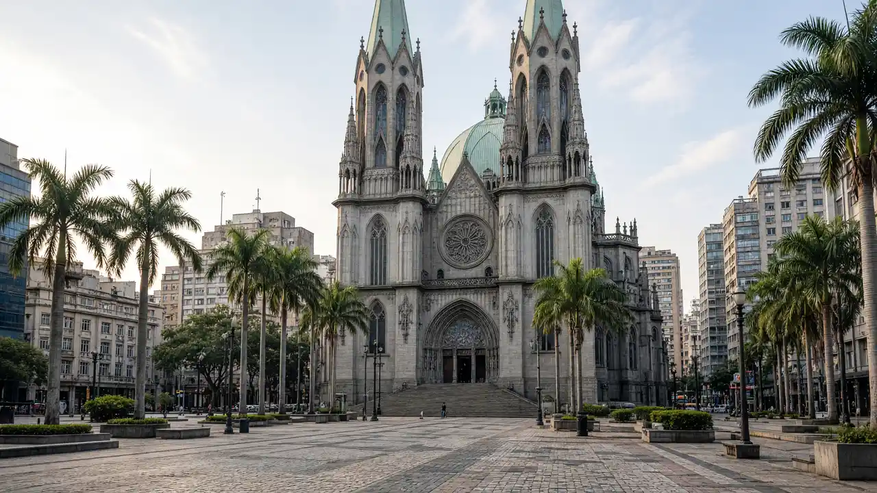
At Sé, first view the silhouette from the square, where towers and central dome can be seen together. Pátio do Colégio shifts attention to lower buildings and a historic site. Martinelli and Altino Arantes then restore the vertical scale, with different upper-level silhouettes
The theatre and the valley
After São Bento, the route reaches the theatre and Viaduto do Chá. Look beyond façade decoration to the changing levels: the viaduct explains why neighbouring central blocks are connected by a bridge. Continue to Copan separately if time and energy allow
Stops in route order
São Paulo Cathedral — Gothic Revival cathedral with twin towers and a large central dome. View the façade from Praça da Sé and check interior access separately
Pátio do Colégio — Historic city-founding site with a church complex and square. Separate the square walk from museum admission
Altino Arantes Building — High-rise tower with a stepped crown above the historic centre. A Farol Santander visit is separate from the street route
Martinelli Building — Early city skyscraper with ornate upper levels. View upper floors from the street and check rooftop access separately
São Bento Monastery — Monastery complex on a square at the northern edge of the old centre. Check church access against service arrangements
Theatro Municipal — Theatre with elaborate stone decoration beside the Anhangabaú valley. Look at the side façades as well as the main entrance
Viaduto do Chá — Urban bridge across the valley linking parts of the central district. Pause by the railings without blocking pedestrians
Access and planning
Choose daylight and active streets, and follow current barriers around squares. Observation floors, the monastery and theatre have their own entry rules. The walk does not promise access to skyscraper rooftops
Continue with Copan and Edifício Itália, or choose Liberdade for another historical perspective
Map and stops
The numbered markers match the stops below. A marker does not guarantee an open entrance
Access: Approach or exterior view; admission to the interior is not confirmed
São Paulo Cathedral
Gothic Revival cathedral with twin towers and a large central dome
View the façade from Praça da Sé and check interior access separately
Show on the city map ↗Pátio do Colégio
Historic city-founding site with a church complex and square
Separate the square walk from museum admission
Show on the city map ↗Altino Arantes Building
High-rise tower with a stepped crown above the historic centre
A Farol Santander visit is separate from the street route
Show on the city map ↗Martinelli Building
Early city skyscraper with ornate upper levels
View upper floors from the street and check rooftop access separately
Show on the city map ↗São Bento Monastery
Monastery complex on a square at the northern edge of the old centre
Check church access against service arrangements
Show on the city map ↗Theatro Municipal
Theatre with elaborate stone decoration beside the Anhangabaú valley
Look at the side façades as well as the main entrance
Show on the city map ↗Viaduto do Chá
Urban bridge across the valley linking parts of the central district
Pause by the railings without blocking pedestrians
Show on the city map ↗
Before the walk
- Downtown pavements, squares and a viaduct
- Walking time excludes exhibitions, queues and long breaks
- Calculated using the OSM pedestrian network; not verified by an on-site walk
- View buildings from outside; closed courtyards and interior passages are not essential parts of the walk
Check hours, tickets and access with each venue. Barriers may change the track and queues may add time. Accessibility has not been surveyed on site
Questions before the walk
How long is this walk?
The mapped route is 2.3 km, with about 35 minutes of walking at an assumed 4.2 km/h. Breaks, visits and terrain can increase the total time
What should be checked before setting out?
Choose daylight and active streets, and follow current barriers around squares. Observation floors, the monastery and theatre have their own entry rules. The walk does not promise access to skyscraper rooftops
How can the walk be shortened or continued?
Continue with Copan and Edifício Itália, or choose Liberdade for another historical perspective
Sources and verification
Written by walkymap from remotely checked sources. No on-site walk is claimed
www.sp.gov.br — www.sp.gov.br ·
en.wikipedia.org — São Paulo Cathedral ·
en.wikipedia.org — Pátio do Colégio ·
en.wikipedia.org — Altino Arantes Building ·
en.wikipedia.org — Martinelli Building ·
www.openstreetmap.org — www.openstreetmap.org ·
en.wikipedia.org — Theatro Municipal (São Paulo) ·
en.wikipedia.org — Viaduto do Chá ·
© OpenStreetMap contributors · ODbL. Track geometry and distance are from the route dataset
Elevation estimate: Mapterhorn. Terrain model; stairs and small changes in level may be missed