A World Apart memorial → Savannah City Hall
Start at A World Apart memorial, pass City Hall and descend towards the riverside warehouses; use an open gradual approach instead of old stairs if needed
A World Apart memorial: Split globe forming a Second World War memorial
Savannah City Hall: Domed city hall at the river end of Bull Street
African-American Monument → River Street
Follow the open riverfront to the Waving Girl memorial; leave boat docks outside the walk
African-American Monument: Memorial to African Americans on the historic riverfront
River Street: Waterfront street with old warehouse façades and cobbled approaches
The Waving Girl → Old Harbor Light
Return to the upper level at Emmet Park and the old harbour light; allow pauses on uneven cobblestones
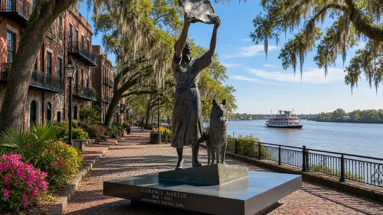
The Waving Girl: Riverfront memorial to Florence Martus at the eastern end of the waterfront
Old Harbor Light: Small iron harbour light above the historic waterfront
Map and stops
The numbered markers match the stops below. A marker does not guarantee an open entrance
Access: Approach or exterior view; admission to the interior is not confirmed
A World Apart memorial
Split globe forming a Second World War memorial
Stay on the open pedestrian path; avoid closed docks
Show on the city map ↗Savannah City Hall
Domed city hall at the river end of Bull Street
View from the street; check interior access separately
Show on the city map ↗African-American Monument
Memorial to African Americans on the historic riverfront
View from the street; check interior access separately
Show on the city map ↗Rousakis Riverfront Plaza
Open space beside the docks overlooking the Savannah River
Stay on the open pedestrian path; avoid closed docks
Show on the city map ↗River Street
Waterfront street with old warehouse façades and cobbled approaches
View from the street; check interior access separately
Show on the city map ↗The Waving Girl
Riverfront memorial to Florence Martus at the eastern end of the waterfront
Stay on the open pedestrian path; avoid closed docks
Show on the city map ↗Emmet Park
Green strip on the upper level of the waterfront
Use open paths; account for weather and closed sections
Show on the city map ↗Old Harbor Light
Small iron harbour light above the historic waterfront
View from the street; check interior access separately
Show on the city map ↗
Before the walk
- Check a suitable descent to the river before starting
- Keep boat docks outside the walk and follow the open riverfront
- The route is not confirmed step-free; use open streets around closed sites
Check hours, tickets and access with each venue. Barriers may change the track and queues may add time. Accessibility has not been surveyed on site
Questions before the walk
Does the walk include admission to interiors?
The map links exterior viewpoints and approaches; museum visits, religious services and private buildings follow separate access rules
Is the whole walk on one level?
No — River Street lies below Emmet Park and City Hall, with stairs and cobbled slopes between levels
Sources and verification
Written by walkymap from remotely checked sources. No on-site walk is claimed
savannahga.gov — savannahga.gov ·
savannahga.gov — savannahga.gov ·
visitsavannah.com — visitsavannah.com ·
visitsavannah.com — visitsavannah.com ·
savannahga.gov — savannahga.gov ·
© OpenStreetMap contributors · ODbL. Track geometry and distance are from the route dataset
Elevation estimate: Mapterhorn. Terrain model; stairs and small changes in level may be missed