From the street slope to the Pantheon
The Bozardjiants mansion can be viewed from the street. The stop allows an energy check before the remaining climb. Water and shoes with good grip are needed. The time estimate does not require rushing; pace depends on physical condition
The Pantheon beside Mamadaviti has memorial inscriptions and a hillside setting. A quiet visit is appropriate. Weather, remaining daylight and tiredness need assessing here. Deteriorating conditions are a reason to change the plan before the wooded section
Allow time for the view and return
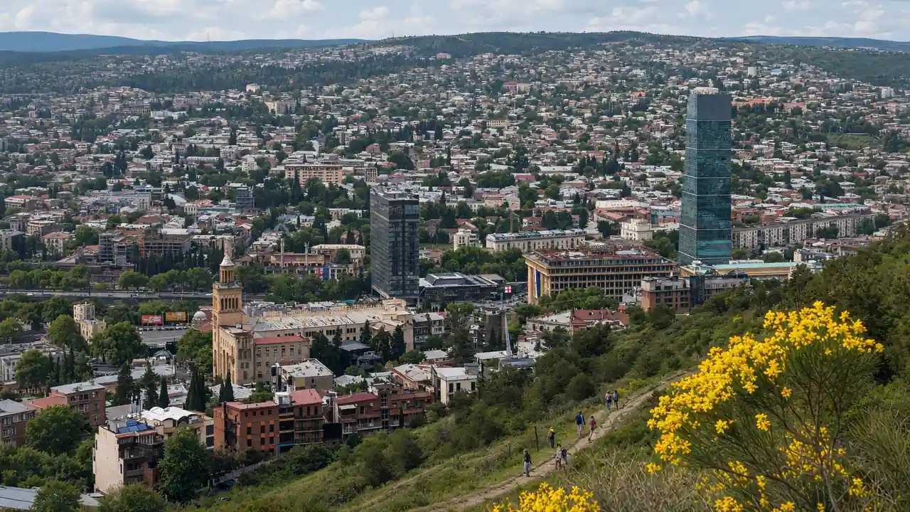
The summit overlooks the river, central Tbilisi and the direction of the climb. The park offers a pause after the ascent. The TV tower is an exterior landmark. Access to its technical grounds and an ascent of the tower are not included
A funicular ride is not part of the walking track. An operating station and service need checking separately. In rain or darkness, an available transport option is needed instead of the trail. The descent needs advance planning: the route distance ends uphill and excludes the return
Map and stops
The numbered markers match the stops below. A marker does not guarantee an open entrance
Freedom Square
The central square and its Saint George monument connect Rustaveli Avenue with the Old Town
Use the square as a starting point for a walk through Sololaki
Show on the city map ↗Bozardjiants House
A 1915 mansion on Chonkadze Street and a striking example of Tbilisi Art Nouveau
View the facade from the street; enter residential stairwells only with permission
Show on the city map ↗Vilnius Square
Show on the city map ↗Mamadaviti Church and Pantheon
A memorial site beside Mamadaviti Church, dedicated to notable writers and public figures
Visit in daylight, allow time to look around and keep quiet
Show on the city map ↗Funicular — Pantheon station
A historic hillside railway climbing towards Mtatsminda
The marker shows the railway alignment; to board, find the lower station on Chonkadze Street
Show on the city map ↗Viewpoint by the funicular
Show on the city map ↗Park viewpoint
A hilltop park with rides and a broad panorama of Tbilisi
Choose clear weather for the views and check transport before heading uphill
The viewpoint is on the eastern side of the park; the place marker indicates the centre of the large park
Show on the city map ↗TV Tower — exterior view by the fence
The tall tower on Mtatsminda is one of the city's defining skyline landmarks
View from outside: regular tourist access up the tower is not advertised
A stop on the park side of the TV Tower fence; the route does not enter the technical grounds or the tower
Show on the city map ↗Viewpoint by the funicular
Show on the city map ↗
Before the walk
- Choose dry conditions and a generous allowance of daylight
- Use the Pantheon for a quiet pause and an assessment of the remaining climb
- Check a way back down before setting out
- This is a physically demanding climb and is not designated as step-free
- In rain or darkness, choose the funicular instead of the walking trail; check its operation separately
- The route finishes at the top; the descent is not included in its length
- The funicular station is an exterior stop to see the hillside railway; a ride is not part of the walking track
- TV Tower: an exterior view from the park only, with no entry to the technical grounds
Check hours, tickets and access with each venue. Barriers may change the track and queues may add time. Accessibility has not been surveyed on site
Questions before the walk
Does the funicular replace part of this route?
The ride changes the walking plan and is outside the pedestrian track. Stations, tickets and current operation need separate checking
Is the television tower open to visitors?
Regular tourist access is not advertised. The final stop is an exterior view from an accessible part of the park, without entering technical grounds
Sources and verification
Written by walkymap from remotely checked sources. No on-site walk is claimed
Georgia Travel — Georgian National Tourism Administration — Mount Mtatsminda ·
Georgia Travel — Georgian National Tourism Administration — Tbilisi Television Tower — TV Tower ·
© OpenStreetMap contributors · ODbL. Track geometry and distance are from the route dataset
Elevation estimate: Mapterhorn. Terrain model; stairs and small changes in level may be missed