A building at the gorge edge
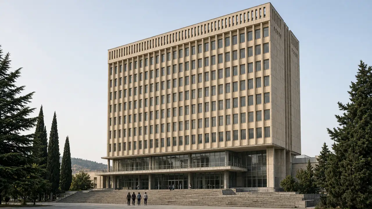
At Maglivi, look at repeated window rows, vertical façade elements and the lower entrance section. A university building is not automatically a public observation deck; the walk stays outside. Terrain matters as much as architecture here, with the building beside a deep break in the city fabric
Footbridge and aerial tramway
Distinguish the older steel footbridge from the neighbouring road bridge. The track uses the pedestrian connection and continues towards Bagebi. The aerial-tramway station is marked as transport architecture; a cabin ride is not part of the route and does not replace checking the walking access
Stops in route order
TSU High-Rise Building — Maglivi — The tower of Building 10 belongs to an experimental modernist university ensemble on University Street. Explore the campus from public paths; teaching interiors require authorised access
Maglivi–Bagebi footbridge — Narrow steel footbridge over the Vere gorge beside the university high-rise. Use only the open crossing; wet steps and metal surfaces are slippery
Bagebi aerial-tramway station — University aerial-tramway station on the Bagebi side. This is an architecture stop; cable-car operation is not assumed in the walking route
Access and planning
Bridge surfaces and steps may be slippery. If the crossing is closed, do not bypass barriers; return on the same side
Finish on the Bagebi side or return over the open bridge. Nutsubidze’s linked housing blocks belong to a separate walk
Map and stops
The numbered markers match the stops below. A marker does not guarantee an open entrance
Access: Approach or exterior view; admission to the interior is not confirmed
TSU High-Rise Building — Maglivi
The tower of Building 10 belongs to an experimental modernist university ensemble on University Street
Explore the campus from public paths; teaching interiors require authorised access
Show on the city map ↗Maglivi–Bagebi footbridge
Narrow steel footbridge over the Vere gorge beside the university high-rise
Use only the open crossing; wet steps and metal surfaces are slippery
Show on the city map ↗Bagebi aerial-tramway station
University aerial-tramway station on the Bagebi side
This is an architecture stop; cable-car operation is not assumed in the walking route
Show on the city map ↗
Before the walk
- Vere gorge, steps and a narrow steel bridge
- Walking time excludes visits, transport, queues and long breaks
- Calculated using the OSM pedestrian network; not verified by an on-site walk
- Use only open paths and public approaches; check indoor admission separately
Check hours, tickets and access with each venue. Barriers may change the track and queues may add time. Accessibility has not been surveyed on site
Questions before the walk
How long is this walking route?
The mapped track is 1.2 km, with about 20 minutes of walking at an assumed 4.2 km/h. Reaching the start, visits and breaks are separate
What access arrangements need checking?
Bridge surfaces and steps may be slippery. If the crossing is closed, do not bypass barriers; return on the same side
How can this visit be shortened or continued?
Finish on the Bagebi side or return over the open bridge. Nutsubidze’s linked housing blocks belong to a separate walk
Sources and verification
Written by walkymap from remotely checked sources. No on-site walk is claimed
georgia.travel — georgia.travel ·
www.geoair.ge — www.geoair.ge ·
www.totallylost.eu — www.totallylost.eu ·
www.openstreetmap.org — www.openstreetmap.org ·
www.openstreetmap.org — www.openstreetmap.org ·
© OpenStreetMap contributors · ODbL. Track geometry and distance are from the route dataset
Elevation estimate: Mapterhorn. Terrain model; stairs and small changes in level may be missed