Look at changes of use
The former communications building and Iveria hotel introduce the theme. Their present appearance should not be presented as an unchanged Soviet-era scene. The concert hall, Chess Palace and scientific-technical library then show how large public functions were fitted into the slope and city blocks
Laguna Vere: exterior only
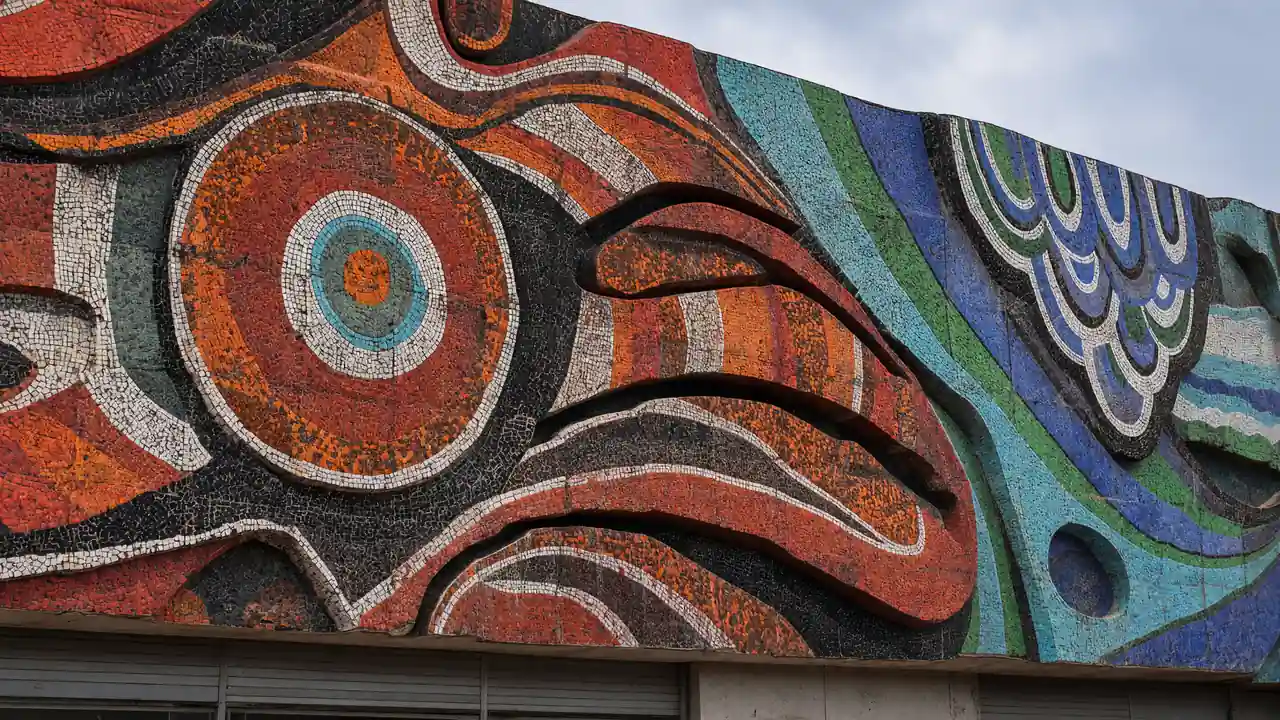
In a 2024 statement, the architecture archive reported continuing partial dismantling of the complex. This guide therefore promises no operating pool, site admission or survival of every detail. The mosaic façade is a reason for careful exterior viewing from a public street if visible; check current condition and barriers locally
Stops in route order
Former communications building — Telegraph — Large former communications building beside First Republic Square, now used as a hotel. Compare its façade with the former Iveria hotel from the street
Iveria Hotel — Radisson Blu — The rebuilt 18-storey Iveria hotel is a prominent part of upper Rustaveli's skyline. View the tall silhouette from First Republic Square; a public rooftop observation deck is not advertised
Tbilisi Concert Hall — The circular concert hall beside Vera Park has hosted concerts and festivals since 1971. Look at the building's round form; choose an event to visit the auditorium
Nona Gaprindashvili Chess Palace — This 1973 modernist building is set into the terrain of Vera Park. Combine an exterior stop with the park; ask separately about going inside
Scientific and Technical Library — Distinctive library building at the northern edge of Vera. View the façade from the street; reading rooms may require registration
Laguna Vere exterior — Former Soviet aquatic sports complex with a mosaic façade, closed and partially dismantled. View only from a public street; check the mosaic’s condition and visibility on site
Galaktion Tabidze Bridge — Bridge with substantial arches and decorative railings between Vera and the left bank. View the river panorama from the pavement, keeping out of traffic
Access and planning
Do not enter the closed complex. If the façade is hidden, skip the stop and continue to Galaktion Bridge
For a lighter outing, keep First Republic Square and the concert hall; visit the library section separately
Map and stops
The numbered markers match the stops below. A marker does not guarantee an open entrance
Access: Approach or exterior view; admission to the interior is not confirmed
Former communications building — Telegraph
Large former communications building beside First Republic Square, now used as a hotel
Compare its façade with the former Iveria hotel from the street
Show on the city map ↗Iveria Hotel — Radisson Blu
The rebuilt 18-storey Iveria hotel is a prominent part of upper Rustaveli's skyline
View the tall silhouette from First Republic Square; a public rooftop observation deck is not advertised
Show on the city map ↗Tbilisi Concert Hall
The circular concert hall beside Vera Park has hosted concerts and festivals since 1971
Look at the building's round form; choose an event to visit the auditorium
Show on the city map ↗Nona Gaprindashvili Chess Palace
This 1973 modernist building is set into the terrain of Vera Park
Combine an exterior stop with the park; ask separately about going inside
Show on the city map ↗Scientific and Technical Library
Distinctive library building at the northern edge of Vera
View the façade from the street; reading rooms may require registration
Show on the city map ↗Laguna Vere exterior
Former Soviet aquatic sports complex with a mosaic façade, closed and partially dismantled
View only from a public street; check the mosaic’s condition and visibility on site
Show on the city map ↗Galaktion Tabidze Bridge
Bridge with substantial arches and decorative railings between Vera and the left bank
View the river panorama from the pavement, keeping out of traffic
Show on the city map ↗
Before the walk
- Hilly streets, steps and exterior views of closed buildings
- Walking time excludes visits, transport, queues and long breaks
- Calculated using the OSM pedestrian network; not verified by an on-site walk
- Use only open paths and public approaches; check indoor admission separately
Check hours, tickets and access with each venue. Barriers may change the track and queues may add time. Accessibility has not been surveyed on site
Questions before the walk
How long is this walking route?
The mapped track is 3.2 km, with about 50 minutes of walking at an assumed 4.2 km/h. Reaching the start, visits and breaks are separate
What access arrangements need checking?
Do not enter the closed complex. If the façade is hidden, skip the stop and continue to Galaktion Bridge
How can this visit be shortened or continued?
For a lighter outing, keep First Republic Square and the concert hall; visit the library section separately
Sources and verification
Written by walkymap from remotely checked sources. No on-site walk is claimed
georgia.travel — georgia.travel ·
www.geoair.ge — www.geoair.ge ·
www.openstreetmap.org — www.openstreetmap.org ·
georgia.travel — georgia.travel ·
georgia.travel — georgia.travel ·
georgia.travel — georgia.travel ·
www.openstreetmap.org — www.openstreetmap.org ·
www.openstreetmap.org — www.openstreetmap.org ·
© OpenStreetMap contributors · ODbL. Track geometry and distance are from the route dataset
Elevation estimate: Mapterhorn. Terrain model; stairs and small changes in level may be missed