Distinguish the two “parliaments”
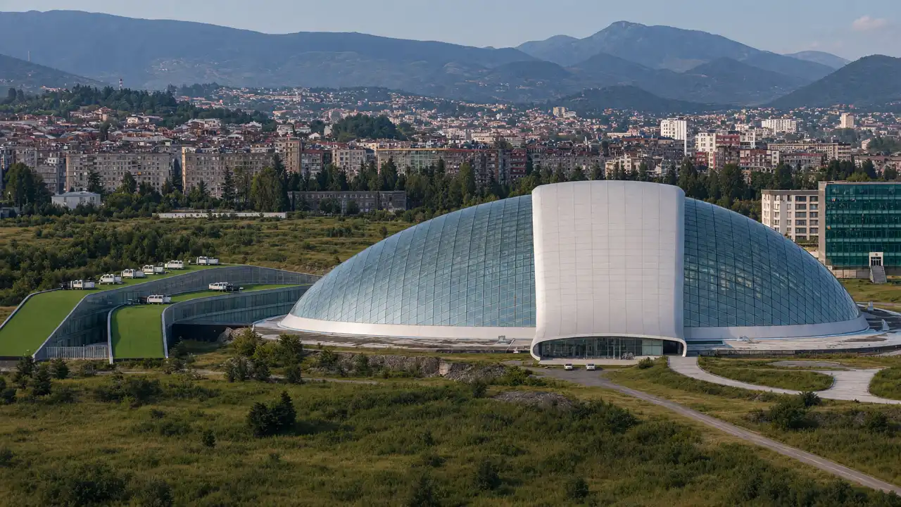
Local stories sometimes use “parliament” for a meeting place in the Central Garden. This guide concerns the former state building with the glass dome in the west. Kutaisi’s official tourism site includes it among the city’s contemporary architecture. The walk treats it as an exterior landmark, not an operating parliamentary tour
Between the garden and the large dome
Starting at the Garden of Glory and pausing by the Bermukha relief links the newer scale with earlier urban art. The route uses ordinary streets with possible noise, wide junctions and exposed sections. Choose it for its architectural theme rather than as the centre’s most picturesque stroll
Stops in route order
Garden of Glory — Small green stop in neighbourhoods southwest of the centre. Use it for a break between neighbourhoods
Bermukha relief — Soviet Bermukha relief in western Kutaisi neighbourhoods. View from the street side; access to the façade may change
Former Parliament building — Glass dome of the former Parliament building in western Kutaisi. View from accessible outdoor space; interior access is not guaranteed
Access and planning
Neither building admission nor unrestricted grounds access is promised. Stay on the public side of barriers
Shorten it to an exterior dome visit after arriving separately; do not try to fit all Kutaisi districts into one short outing
Map and stops
The numbered markers match the stops below. A marker does not guarantee an open entrance
Access: Approach or exterior view; admission to the interior is not confirmed
Garden of Glory
Small green stop in neighbourhoods southwest of the centre
Use it for a break between neighbourhoods
Show on the city map ↗Bermukha relief
Soviet Bermukha relief in western Kutaisi neighbourhoods
View from the street side; access to the façade may change
Show on the city map ↗Former Parliament building
Glass dome of the former Parliament building in western Kutaisi
View from accessible outdoor space; interior access is not guaranteed
Show on the city map ↗
Before the walk
- Western city blocks, wide roads and exposed sections
- Walking time excludes visits, transport, queues and long breaks
- Calculated using the OSM pedestrian network; not verified by an on-site walk
- Use only open paths and public approaches; check indoor admission separately
Check hours, tickets and access with each venue. Barriers may change the track and queues may add time. Accessibility has not been surveyed on site
Questions before the walk
How long is this walking route?
The mapped track is 3.5 km, with about 55 minutes of walking at an assumed 4.2 km/h. Reaching the start, visits and breaks are separate
What access arrangements need checking?
Neither building admission nor unrestricted grounds access is promised. Stay on the public side of barriers
How can this visit be shortened or continued?
Shorten it to an exterior dome visit after arriving separately; do not try to fit all Kutaisi districts into one short outing
Sources and verification
Written by walkymap from remotely checked sources. No on-site walk is claimed
kutaisi.travel — kutaisi.travel ·
www.openstreetmap.org — www.openstreetmap.org ·
www.openstreetmap.org — www.openstreetmap.org ·
© OpenStreetMap contributors · ODbL. Track geometry and distance are from the route dataset
Elevation estimate: Mapterhorn. Terrain model; stairs and small changes in level may be missed