The staircase as a city passage
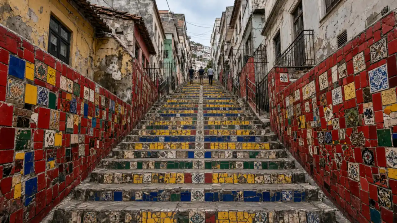
The Selarón mosaic remains part of a passage between neighbourhoods. Look at individual tiles from the side rather than occupying the full width of the steps. Higher up, the streetscape changes from broad squares to bends, garden walls and hillside houses
Ruins and museum gardens
Parque Glória Maria, also known as Parque das Ruínas, combines mansion remains with a contemporary cultural venue. Chácara do Céu is nearby, with Benjamin Constant’s house farther along. The three stops offer a choice of a focused visit, but do not guarantee through-access across gardens
Stops in route order
Carioca Aqueduct — Two-tiered white aqueduct carrying the tramway. View the arches from the square; do not enter the tramway level
Escadaria Selarón — Urban staircase covered with colourful tile mosaics. Keep the steps clear for photographs and allow for the climb
Parque Glória Maria — Cultural space within mansion ruins above Santa Teresa. Check viewing-platform access hours separately
Chácara do Céu Museum — House museum with an art collection on the Santa Teresa hillside. Do not cross the museum grounds when closed
Benjamin Constant House Museum — Historic house museum in the hillside neighbourhood. Allow for sloping streets and separate garden access
Access and planning
Plan a daylight walk and check cultural-venue openings and approaches beforehand. The tram is a separate transport option, not an essential part of the walking track. Remain on public streets when an entrance is closed
For a downhill version, reverse the museum route towards Cinelândia
Map and stops
The numbered markers match the stops below. A marker does not guarantee an open entrance
Access · 1, 2: Approach or exterior view; admission to the interior is not confirmed
Carioca Aqueduct
Two-tiered white aqueduct carrying the tramway
View the arches from the square; do not enter the tramway level
Show on the city map ↗Escadaria Selarón
Urban staircase covered with colourful tile mosaics
Keep the steps clear for photographs and allow for the climb
Show on the city map ↗Parque Glória Maria
Cultural space within mansion ruins above Santa Teresa
Check viewing-platform access hours separately
Approach to the park entrance; viewpoint access follows venue arrangements
Show on the city map ↗Chácara do Céu Museum
House museum with an art collection on the Santa Teresa hillside
Do not cross the museum grounds when closed
Stop on Rua Murtinho Nobre beside the museum; admission is separate
Show on the city map ↗Benjamin Constant House Museum
Historic house museum in the hillside neighbourhood
Allow for sloping streets and separate garden access
Stop on Rua Monte Alegre beside the museum; admission is separate
Show on the city map ↗
Before the walk
- Stairs, cobbles and steep slopes
- Walking time excludes exhibitions, queues and long breaks
- Calculated using the OSM pedestrian network; not verified by an on-site walk
- View buildings from outside; closed courtyards and interior passages are not essential parts of the walk
Check hours, tickets and access with each venue. Barriers may change the track and queues may add time. Accessibility has not been surveyed on site
Questions before the walk
How long is this walk?
The mapped route is 2.4 km, with about 35 minutes of walking at an assumed 4.2 km/h. Breaks, visits and terrain can increase the total time
What should be checked before setting out?
Plan a daylight walk and check cultural-venue openings and approaches beforehand. The tram is a separate transport option, not an essential part of the walking track. Remain on public streets when an entrance is closed
How can the walk be shortened or continued?
For a downhill version, reverse the museum route towards Cinelândia
Sources and verification
Written by walkymap from remotely checked sources. No on-site walk is claimed
en.wikipedia.org — Carioca Aqueduct ·
en.wikipedia.org — Escadaria Selarón ·
www.openstreetmap.org — www.openstreetmap.org ·
© OpenStreetMap contributors · ODbL. Track geometry and distance are from the route dataset
Elevation estimate: Mapterhorn. Terrain model; stairs and small changes in level may be missed